The map below is an interactive Google map, showing all the main points of interest we hit, and photos along the way.
View Larger Map
Ads by Google
Posted by ellen at March 14, 2009 03:30 PM
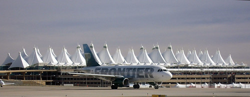
This is not my photo, but I thought the airport was cool enough that you should be able to see it. Thanks Bachir!
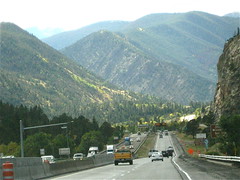 |
On leaving the airport, we took I-70 in a straight shot to Grand Junction where we stayed for a few days. I-70 is one of the most scenic freeways in the US, cutting through mountains, canyons, and stunning desert vistas on its way straight west across the northern part of the state.
|
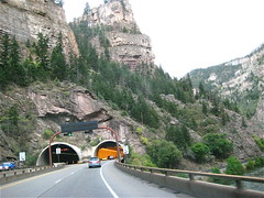 |
The Glenwood Canyon stretch visible from I-70 is beautiful, and the design and the design of the freeway that runs through it is also spectacular, and something of an engineering feat. |
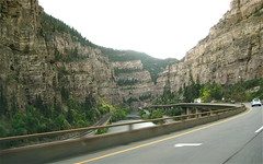 |
This site by a civil engineer describes some of the more outstanding features. |
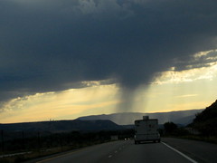 |
Isolated rainstorm somewhere between Rulison and Parachute. |
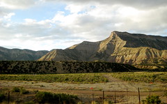 |
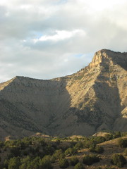
Some of the dramatic scenery on the way into Grand Junction... |
 |
|
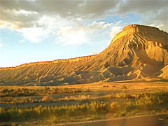 |
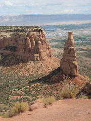
...culminating in this incredible view of a mesa |
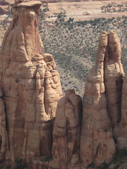
| Just a few miles outside of Grand Junction lies the Colorado National Monument National Park. It's a series of breathtaking canyons and red-rock pillars (the Monuments). | |
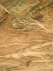 |
Some of the sandstone layers in rocks near the entrance. |
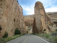 |
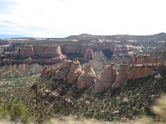
Monument road skirts the edge of the canyons. |
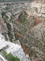 |
Views down into the canyons |
 |
|
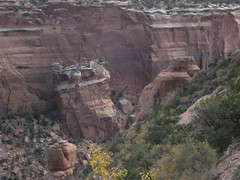 |
You can see the enormous block of rock that sheared off and fell down into the canyon |
 |
|
 |
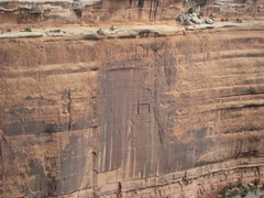
There's a sandstone cave formed by water. The rock is so soft you can sculpt it by brushing sand off with your hand. |
 |
|
 |
Colorado National Monument lies along the northeastern flank of the Uncompahgre Plateau. |
 |
The terrain gives the impression of having been the site of many flash floods which carved the canyons and deeply undercut the top layers of rock in some places. |
 |
The Coke Ovens formation. Read about the geology of the area |
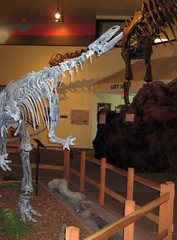 ; ; |
Afterwards we visited the DInosaur Journey Museum in Fruita, a cool interactive museum with animated dinosaurs, fossils, a lab, an earthquake simulator and lots of paleontological information |
Ads by Google
